Hello, I am Roberto
I am a professor of Urban Planning and researcher on Urban Information Systems and Computational Urbanism See my research projects
Roberto Ponce-Lopez
ABOUT ME
I am a professor-researcher of Urban Studies in the Graduate School of Government and Public Transformation, within the Instituto Tecnologico y de Estudios Superiores de Monterrey. My research focuses on combining spatial analysis tools with machine learning and large scale datasets (e.g. Call Detailed Records, Social Media) to model urban morphology, land use, transportation and environmental interactions to build information infrastructures for supporting urban and regional planning. I also have an interest in time-geography to explore social interactions and economic segregation in the urban space.
Roberto holds a Ph.D. degree from the Department of Urban Studies and Planning at the Massachusetts Institute of Technology (MIT). During his time at MIT, he was affiliated to the Urban Information Systems research group. Roberto also holds a Master of Science degree in Public Policy and Management from Carnegie Mellon University.
Interests
Urban Morphology
The spatial location of jobs, leisure and housing, affects the deployment of the transportation network and the activity spaces of people. I utilize data to systematically quantifying and classifying the topology of urban form. My ultimate goal is to understand how people link different spaces through trips and daily activity.
Space-Time Methods of Data Analysis
My work is influenced by the reserch of geographers Torsten Hägerstrand and Mei-Po Kwan. I analyze individual data representing human-trajectories along time and space in the city,to shed new light on topics such as accessibility, destination choice and economic segregation of people.
Machine Learning
My research employs techniques of supervised and unsupervised learning, and pattern recognition, applied to large scale urban datasets to explore urban form, and to represent attributes of the built environment with a systematic and replicable method that captures the attributes that matter to urban planners.
Economic Segregation
I am interested in new methods to study the economic segregation of activity spaces of the city. Especifically, in finding new methods and data that could capture that relationship between urban form and transportation and destination choice of leisure trips. I am puzzled by the segregated spaces within cities, which remain isolated from each other.
My Experience
EGTP @ TEC
2018 - currentSince September 2018, I joined the Graduate School of Government at TEC of Monterrey as professor or urban studies and planning. My time splits between teaching, conducting reasearch, and collaborating with Distrito TEC. The initiative of Distrito TEC is an ambitious project of urban renewal in the decayed neighborhoods surrounding the university.
Ph.D. @ MIT
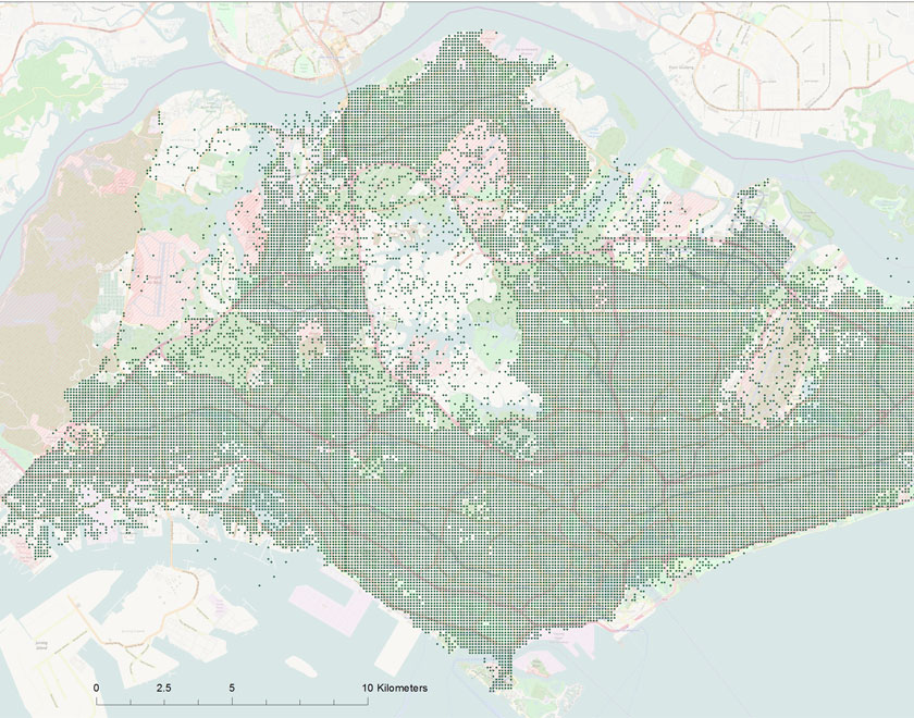
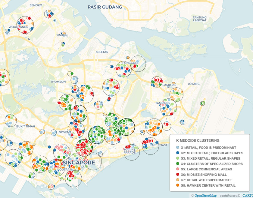
2012 - 2018The title of my dissertation is An Exploration of Non-Work Destinations in Singapore. Prof. Joseph Ferreira (chair), Prof. Amy Glasmeier (reader) and Prof. Jinhua Zhao (reader) formed the Doctoral Committee. My dissertation utilizes data from cellphone activity, Google Place API, and transit data, to develop a number of measures to systematically identify and characterize non-work destinations in Singapore. Completed extensive coursework in programing, urban economics, econometrics and planning theory.
R.A. @ SMART
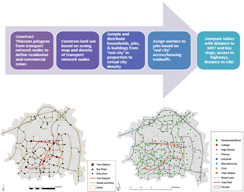
2015 - 2018During my time at MIT, I worked as a Research Assistant in the Singapore - MIT Alliance for Research and Technology (SMART), in the Future Mobility Research Group. I developed a number of the core sub-models of housing relocation for a Land Use and Transportation Integrated (LUTI) simulator called SimMobility, using Random Utility Models.
M.S. @ CMU
2010 - 2012A masters' program in Public Policy at Carnegie Mellon University allowed me to hone and further develop my skills in spatial data management and analytics, by taking courses such as Geographic Information Systems (GIS), Remote Sensing, Database Management and Operations Research.
Government
2006 - 2010I worked in the electoral campaign of Mexican candidate Felipe Calderon, where I was in charge of the GIS and spatial analysis area. Then, I worked for three years in the Bureau of Public Opinion at the Office of the Presidency, being responsible of geostatistics and digital mapping.
B.A. @ ITAM
1999 - 2004I hold a B.A. in Political Science from the Instituto Tecnologico Autonomo de Mexico (ITAM). My dissertation (2009, advisor: Eric Magar Meurs) used GIS to match census tracts and electoral precincts for the federal elections between 1997 and 2003, then fitted a spatial lagged regression to predict percentage of voting for the main parties. The objective was to use spatial statistics to improve the model specification of typical ecological models of voting, while measuring the spatial autocorrelation of vote at a fine geographical scale.
My Research
Data Visualization
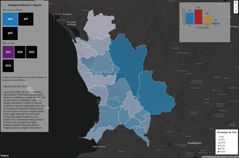
Interactive Maps done in Mapbox + D3
This interactive map of the Mexican state of Nayarit combines Mapbox and D3. The user selects different years and political parties to display the corresponding map. Moreover, a zoom in to the map changes the displayed polygons to the finer geographical scale of census tracts.
See Viz...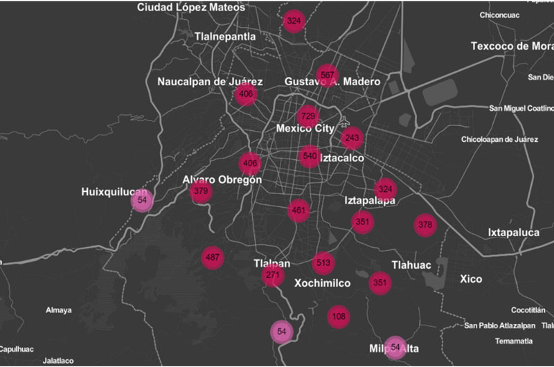
Interactive Maps with Leaflet
This example contains two data visualizations. The first one corresponds to a map of georreferenced points on space. The second one is coropleth map with multiple layers that colors the polygons based on the quantitative variable of selection. The user can swith across layers of information.
See Viz...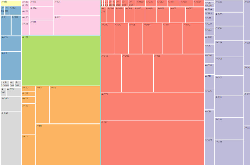
Data visualization in D3
These visualizations were made entirely in D3 as part of a project to commemorate the 100 years of the Mexican Constitution. The series comprise bar plots, scatter plots, network diagrams and areal plots to reflect change in the constitution.
See Viz...Contact Me
Please fill the form below. I will contact you as soon as possible.
